Development of Prototype Tools to Support Resource Mapping, Land Use Development and Planning in Kenya’s Arid and Semi-Arid Lands
The set of maps entitled Nature’s Benefits in Kenya, laid the ground work for an appreciation of the links between ecosystem services and human well-being in Kenya.
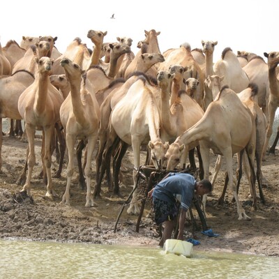
Research by the World Initiative on Sustainable Pastoralism (WISP) and ILRI suggests that in pastoral livestock systems, the link between sustaining pastoral livelihoods and maintaining ecosystem services is particularly crucial as they depend upon one another.
Throughout the dry lands in East Africa, the issue of “alternative” land use investments in traditional pastoral grazing lands is contentious and wide-spread. In addition, new large infrastructure projects such as roads are being implemented to improve market access. The environmental and social impacts of such projects need careful evaluation. Finally, the impacts of climate change for ecosystem goods and services, as well as pastoral livelihoods, bring new uncertainties to prospects for pastoral areas.
Government decision-makers are usually poorly informed of the existing and potential productivity of drylands, and therefore insufficiently aware of the opportunity costs to alternative land use and investment options. Thus presenting concrete evidence and data about the productive potential of livestock systems and their importance for maintaining ecosystems services is an important tool for pastoral policy in East Africa.
Better decisions about land use development in arid lands will help to reduce vulnerability of pastoral livelihoods both currently and in the face of future environmental and economic change. The proposed activities will demonstrate the potential for well-designed spatial analysis to contribute to current policy dialogue for northern Kenya and other arid lands. This presents a model for similar policy engagement in other pastoral areas of East and West Africa.
OBJECTIVES
- Compile baseline data from Nature’s Benefits in Kenya and update selected spatial data sets relevant for the planning and implementation of activities envisioned under the proposed joint donor arid and semi-arid lands development program.
- Conduct an economic valuation of selected ecosystem services in the Ewaso Ng’iro watershed, including the contiguous districts of Laikipia, Isiolo, Samburu and Garissa.
- Assess the impact of changing water availability in downstream areas (using the Ewaso Ng’iro as a case study) due to both potential future climate change and more intensive use of water upstream. Explore the potential impacts of future climate change on other ecosystem services.
- Assess the environmental impact of the proposed railroad to Sudan, to demonstrate to decision-makers the possible environmental as well as developmental considerations surrounding the railroad.
- Demonstrate prototype tools and analysis (drawing on activities above) to Government of Kenya staff and other stakeholders.


