


Spatial planning to spur rangeland-based development across northern Kenya’s ‘frontier counties’
By Irene Nganga and Lance Robinson
Spatial planning is often perceived as being synonymous with ‘urban planning’. However, its scope is much wider, encompassing both rural and urban land use as well as environmental planning and strategizing future development.
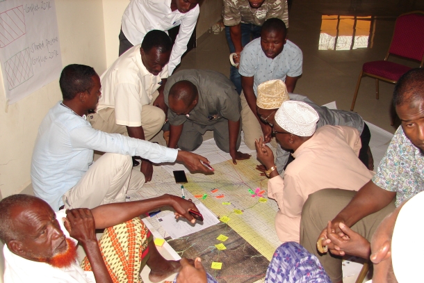 Local experts from northern Kenya map livestock routes for input into spatial planning (photo credit ILRI/Lance Robinson).
For the past couple of years, the contribution of the International Livestock Research Institute (ILRI) to county spatial planning in northern Kenya has come through a partnership with the Kenya National Land Commission. This partnership has mapped stock routes and other key rangeland resources and livestock-related infrastructure. The two organizations are also working together to develop tools and guidelines to aid spatial planning in pastoralist settings.
They have also collaborated with the Frontier Counties Development Council (FCDC)[1] to jointly host two policy dialogues on connections between county spatial planning and rangeland-based development…
View original post 628 more words


")
")