


Empowering every voice: Participatory GIS can transform resource management and gender inclusion. Case story of Isiolo County, Kenya
In the arid landscapes of Isiolo County in the upper eastern region of Kenya, managing rangeland resources is more than a necessity—it’s the key to survival for the region’s pastoralist communities. But effective resource management requires an understanding that reaches beyond the terrain, one that captures the insights, histories, and wisdom of the people who know these lands best.
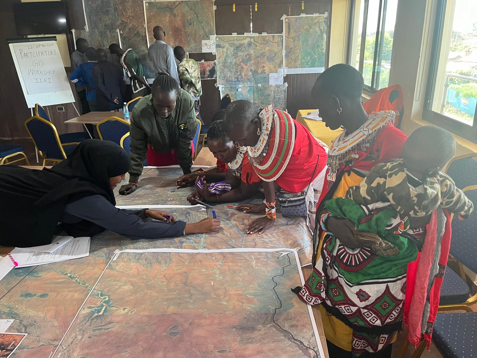
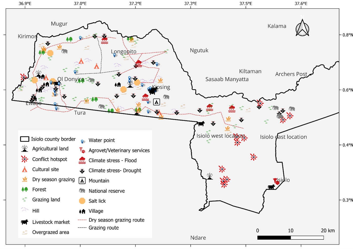
A recent participatory geographic information systems (PGIS) initiative, conducted by a team from the International Livestock Research Institute (ILRI) and its partners in May 2024, demonstrated how community-driven mapping can effectively enhance resource mapping accuracy by bringing new voices, particularly women’s, into the planning process.
Shifting the paradigm of resource mapping
Traditionally, resource mapping has followed a top-down approach. Experts, often external to the communities, help map out grazing areas, water sources, and routes without the critical, local knowledge that determines where these resources exist. PGIS, in contrast, combines advanced mapping technology with the voices of the people living on these lands.
During a three-day workshop in Isiolo in May 2024 men and women gathered around maps, sharing insights on grazing routes, water points, and areas prone to conflict. These weren’t just maps; they were a shared creation, rooted in local context and brimming with practical relevance.
The power of women’s insights
In pastoralist societies, men and women hold different roles, each contributing unique knowledge of their shared environment. The community driven PGIS exercise in Isiolo brought women into the mapping process as active participants, and the outcomes look promising.
“Women contributed detailed knowledge about seasonal water sources, household-level resource use, and water management that might otherwise be overlooked. Their input was invaluable, especially in highlighting family resources and essential care points for livestock and people alike,” explains Ambica Paliwal, senior scientist at ILRI.
A pathway to resilience and inclusivity
The PGIS approach in Isiolo has shown that participatory mapping isn’t just about creating a map. It’s about fostering community resilience, inclusivity, and sustainable resource management and showed the importance of gender inclusion in community planning. By capturing a full spectrum of community needs, the maps produced through PGIS reflect people’s lived experiences and offer data that supports collaborative local planning and resource stewardship in the face of climate pressures.
Acknowledgements
This activity was implemented through the CGIAR Livestock and Climate Initiative, which is funded through the CGIAR Trust Fund.


")
")