


Mapping Kenya’s livestock routes: The arteries of dryland pastoral economy
Kenya has taken a landmark step in strengthening its livestock sector and advancing regional integration through the first-ever mapping of its national livestock routes.
In May 2025, the Supporting Pastoralism and Agriculture in Recurrent and Protracted Crises (SPARC) project, together with the Intergovernmental Authority on Development (IGAD) Centre for Pastoral Areas and Livestock Development (ICPALD), convened a three-day national livestock route mapping forum in Nairobi.
Hosted in collaboration with the State Department for Livestock Development and led technically by the International Livestock Research Institute (ILRI), the event brought together 55 experts drawn from all 47 counties, government officials, private sector actors and regional bodies.
The forum systematically charted Kenya’s vital migratory corridors, grazing areas, water points, markets and infrastructure that underpin livestock mobility. It marked the first time Kenya has translated community knowledge of livestock pathways into comprehensive, authoritative digital maps.
These maps will be integrated into the country’s National Livestock Market Information System, providing producers, traders and policymakers with accurate and timely information.
Why mapping matters
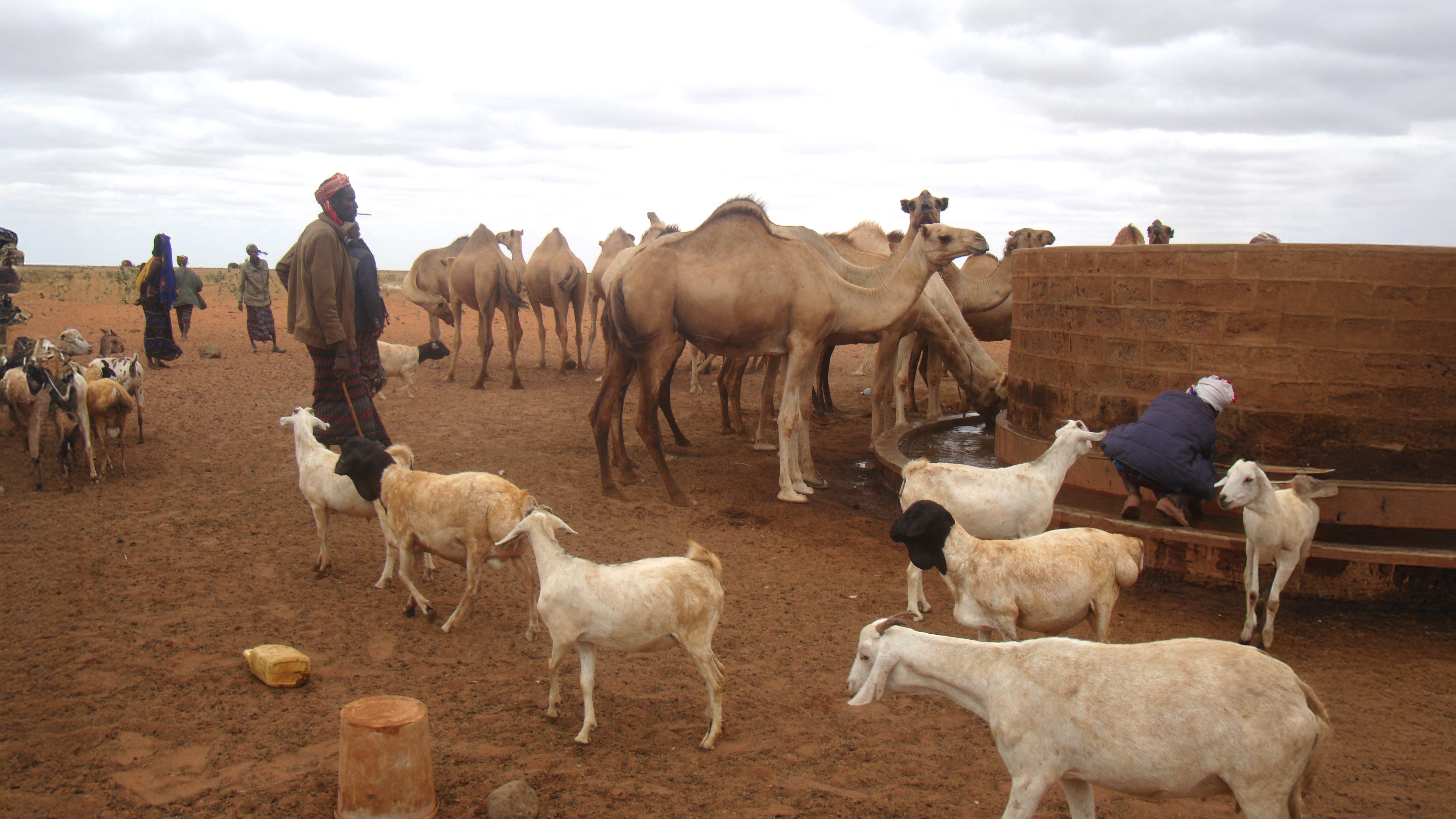
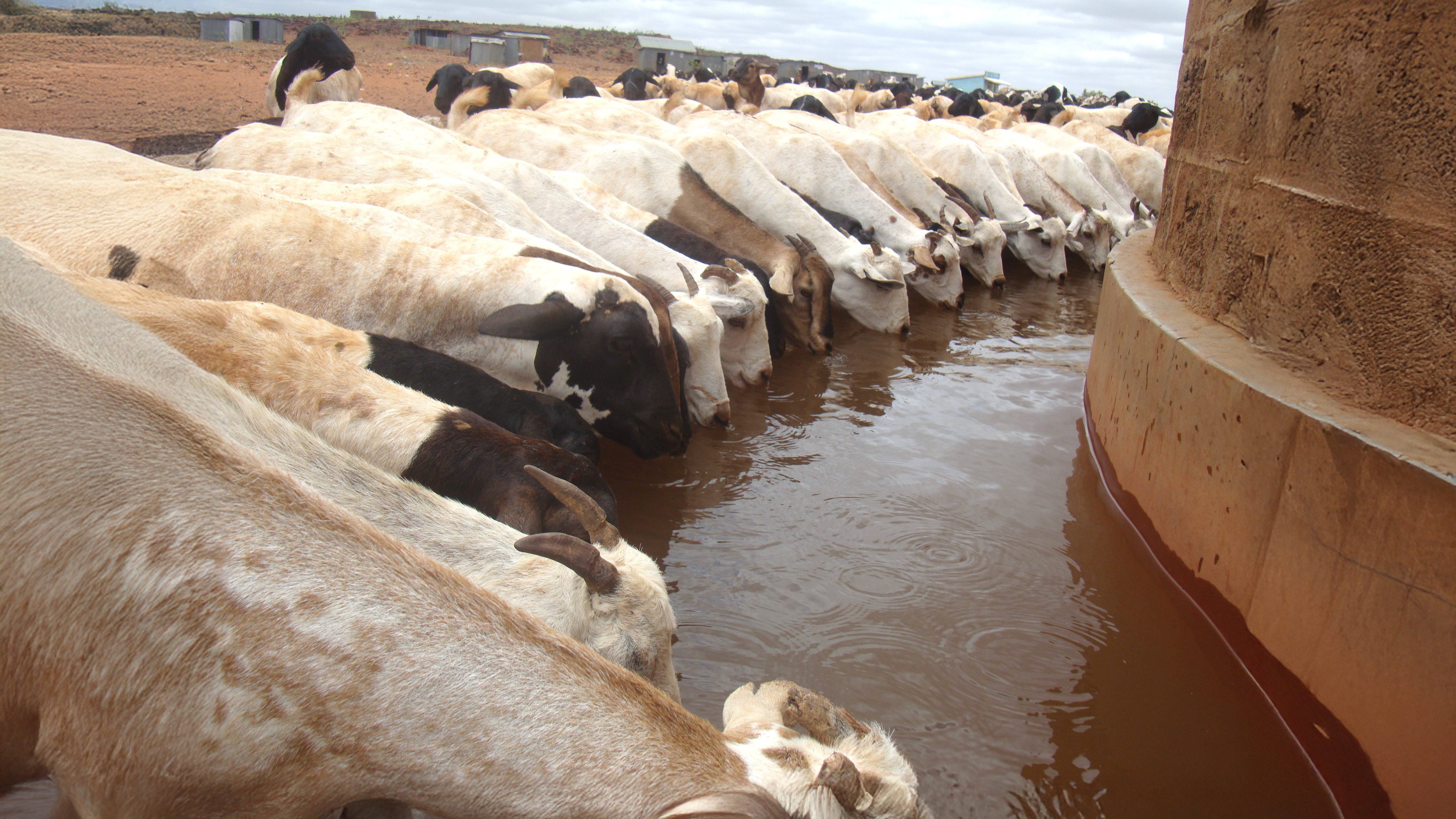
Livestock mobility is the lifeline of Kenya’s pastoral economy, valued at more than US$1.1 billion, and is also central to regional trade within the IGAD bloc. Pastoralists rely on open routes to access grazing lands and water sources, but these pathways face mounting threats. Land subdivision, climate change, invasive species, infrastructure development and weak policy enforcement are increasingly fragmenting routes, undermining access to resources, fueling conflict and accelerating land degradation.
By documenting and digitizing these routes, Kenya’s mapping initiative aims to safeguard pastoral mobility across county and national borders. The outputs will guide future investments in veterinary services, pasture development, water infrastructure and markets, ensuring that pastoral livelihoods are protected while boosting the resilience of the livestock sector.
Speaking at the opening of the workshop, Blaise Okinyi Akite, assistant director of livestock production at the State Department for Livestock Development, emphasized the urgency:
'Without mobility, pastoralism cannot survive. This mapping exercise comes at a critical time when land use changes across many counties are threatening the very foundation of our livestock systems.'
Anchored in local expertise
A participatory approach was central to the process. County livestock officers, veterinary specialists, range management experts, and private sector actors brought localized insights that blended traditional knowledge with modern planning tools.
Working with detailed topographic maps, participants identified livestock corridors, grazing areas, markets, and infrastructure. These findings were validated through peer review and consultations, ensuring accuracy and community ownership.
Mohammed Yahya Said, an ILRI researcher who led the technical mapping sessions, described the initiative as transformative:
'What we are producing is more than maps; it is a foundation for smarter planning, better investments, and more resilient pastoral systems. These routes are the arteries of our livestock economy and understanding them is critical for the future of both people and animals.'
The IGAD region: Africa’s livestock powerhouse
The initiative is not only a national milestone but also part of a wider regional effort. Spanning Djibouti, Eritrea, Ethiopia, Kenya, Somalia, South Sudan, Sudan and Uganda, the IGAD region is one of Africa’s most significant livestock zones.
It supports 43% of the continent’s cattle (160 million), 34% of its sheep and goats (308 million), and nearly half of the world’s camels (19 million) amounting to 488 million animals.
These assets are managed largely by pastoralist communities in arid and semi-arid lands, contributing up to 70% of agricultural GDP in some member states. Livestock exports, mainly to the Middle East, provide a vital source of income and foreign exchange. Despite climate challenges, livestock remains central to livelihoods, food security, and nutrition across the region.
Earlier in 2025, Ethiopia also undertook a similar mapping exercise, setting a precedent that Kenya has now followed. Tanzania has already mapped its livestock routes. These exercises signal a regional shift toward coordinated planning and cross-border cooperation.
Aligning with the IGAD protocol on transhumance
Kenya’s mapping aligns closely with the IGAD protocol on transhumance, a regional framework designed to legalize and facilitate safe, orderly cross-border movement of pastoralists and their herds. By providing precise data on routes and infrastructure, Kenya’s initiative directly supports the protocol’s operationalization.
Japheth Kasimbu, project coordinator for transhumance at IGAD-ICPALD, highlighted the protocol’s transformative potential:
'The protocol is not merely a legal document -it is a strategic framework to restore dignity, security, and opportunity to pastoralists across the region.'
From documentation to action
The new livestock maps are expected to inform policies, budget allocations, and County Integrated Development Plans. Plans are underway for broader consultations and community engagement to validate the maps and ensure they are used to guide real-world investments. The State Department for Livestock Development is set to officially endorse the maps, signalling the beginning of their use in shaping Kenya’s livestock future.
Fabian Kausche, ILRI Deputy Director General for Research and Innovation, closed the forum by affirming ILRI’s commitment:
'Mapping livestock is a strategic tool for resilience, food security, and smarter investment. The participatory spirit and collaboration we’ve seen here will drive meaningful, lasting change.'
More than an exercise in data collection, the process has laid a foundation for securing pastoral livelihoods, strengthening national economies, and fostering regional integration in the face of growing climate and development pressures.
Acknowledgements
Kenya’s livestock route mapping was funded by SPARC and implemented in collaboration with county governments, IGAD-ICPALD, ILRI and the State Department for Livestock Development.


")
")